The Ground Beneath You Is Moving Right Now
Team Ilm Ora · 12 September 2026
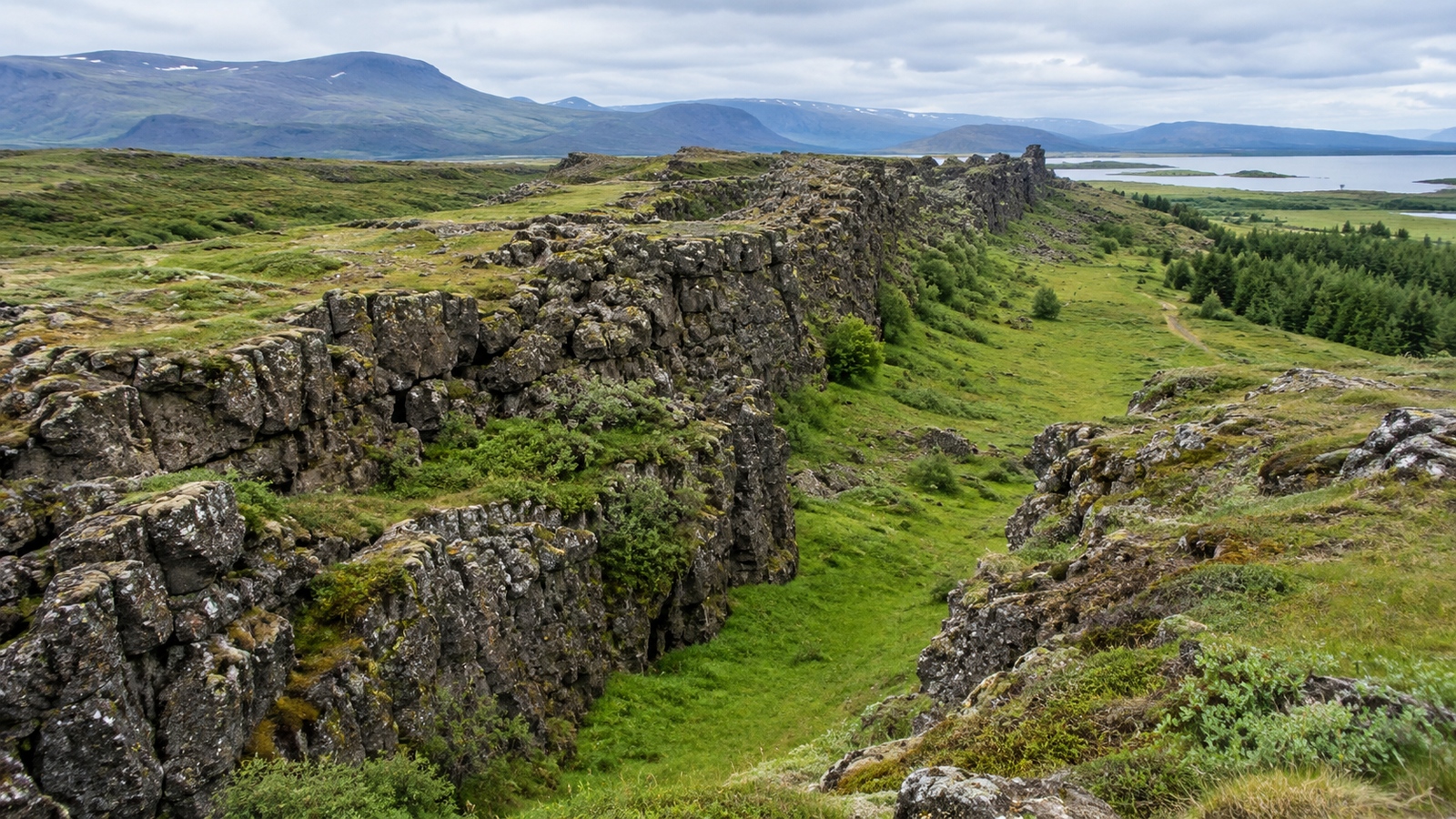
Wherever you are reading this, the solid ground beneath you has moved several centimeters since this time last year — and it's been doing that, without stopping, for billions of years.
An Idea That Took 50 Years to Be Taken Seriously
In 1912, a German scientist named Alfred Wegener proposed something that sounded, to most of his colleagues, faintly ridiculous: that Earth's continents weren't fixed in place, but had once been joined together in a single landmass, and had since drifted apart. He called this idea continental drift. His evidence was genuinely compelling — matching fossils of the same ancient reptiles found on both South America and Africa, matching rock layers and coastlines across the Atlantic Ocean, as if the two continents were puzzle pieces that had been pulled apart.
The problem was, Wegener couldn't explain how solid continents could possibly plow through solid ocean floor. Without a believable mechanism, most geologists dismissed the idea, and it sat largely ignored for decades after Wegener's death in 1930.
The Missing Piece: The Ocean Floor Is Actively Splitting Apart
The breakthrough came from an unexpected source: a U.S. Navy officer and geologist named Harry Hess, who had spent part of World War II conducting ocean-floor surveys from his ship in between naval battles. After the war, expanded ocean mapping revealed something strange: a continuous underwater mountain range, called a mid-ocean ridge, running down the middle of the Atlantic Ocean, with a deep valley splitting straight down its center.
In 1962, Hess proposed an explanation, in a paper called "History of Ocean Basins": molten rock from deep inside the Earth was rising up through that central valley, cooling into new ocean floor, and pushing the older floor outward on both sides — a process that came to be called seafloor spreading. This gave Wegener's old idea exactly what it had been missing: an actual physical mechanism. Continents weren't plowing through the ocean floor on their own. They were passively riding along on top of huge moving plates of crust, carried outward by new ocean floor constantly being created beneath them. By the late 1960s, geologist J. Tuzo Wilson helped combine these ideas into the unified theory now called plate tectonics: Earth's outer shell is broken into roughly a dozen major rigid plates, floating on a slowly shifting layer of hot rock beneath them, in constant, slow motion.
How Fast Is "Slow," Exactly?
Tectonic plates typically move somewhere between about 1 and 10 centimeters per year — a range that's genuinely comparable to how fast your fingernails grow, which is usually cited as a rough real-world comparison. The Pacific Plate, one of the fastest, moves at roughly 7 to 10 centimeters a year, and in some specific locations — like the East Pacific Rise, a stretch of mid-ocean ridge in the South Pacific — the seafloor spreads apart at over 15 centimeters a year. Slower-moving plates, like sections of the Eurasian Plate, can crawl at just a couple of millimeters a year.
None of this is guesswork anymore. Scientists now track plate motion in real time using GPS satellite stations fixed to bedrock around the world, precise enough to detect movement down to the millimeter. Along California's San Andreas Fault — the boundary where the Pacific Plate grinds sideways against the North American Plate — GPS measurements show a deep slip rate of about 20 millimeters (2 centimeters) a year, a movement small enough to be invisible day to day, but large enough, over centuries, to have shifted the ground on either side of the fault by many meters.
The Three Ways Plates Interact
Depending on which direction two neighboring plates are moving relative to each other, their shared boundary behaves in one of three distinct ways:
Pulling apart (divergent boundaries): New molten rock rises up to fill the gap, forming new crust — this is exactly what's happening at the mid-ocean ridges Harry Hess studied, slowly widening oceans like the Atlantic. Colliding (convergent boundaries): When two plates crash into each other, one of two things happens. If one plate is thin, dense ocean floor and the other is thicker continental crust, the ocean floor gets forced downward beneath the other — called subduction — carving out deep ocean trenches like the Mariana Trench in the process. If both plates carry thick continental crust, neither one can easily sink, so the crust crumples and folds upward instead — this collision, between the plate carrying India and the plate carrying the rest of Asia, is what's actively still pushing the Himalayas, including Mount Everest, higher today. Sliding past each other (transform boundaries): Two plates grind sideways past one another without creating or destroying crust — the source of California's San Andreas Fault, and the reason that region experiences frequent earthquakes as built-up pressure releases in sudden jolts.
Rewinding and Fast-Forwarding the Map
Because plate movement is steady and measurable, geologists can run the process backward and forward like a very slow film. Roughly 300 to 320 million years ago, essentially all of Earth's landmasses were fused into a single supercontinent geologists call Pangaea — the same word Wegener himself coined, from Greek roots meaning "all Earth." Pangaea eventually broke apart into the separate continents we recognize today, still slowly drifting.
Running the same process forward instead of backward, geologists including Christopher Scotese have proposed what Earth's map might look like roughly 250 million years from now, building on an idea first proposed by J. Tuzo Wilson that supercontinents form and break apart in a recurring cycle over hundreds of millions of years. One leading model, sometimes called Pangea Proxima ("the next Pangea"), predicts the continents drifting back together into a new supercontinent — driven by the exact same slow forces, at the exact same fingernail-growth pace, that are moving the ground beneath you today.
Why This Should Feel Less Abstract Than It Sounds
It's easy to file "the continents move" away as a piece of trivia you learned in school and never thought about again. But this isn't a historical curiosity confined to ancient fossils and old maps — it's an active, ongoing, currently-measurable process. The same forces that split Pangaea apart 300 million years ago are, at this exact moment, widening the Atlantic Ocean by a few centimeters a year, grinding California slowly northward along the San Andreas Fault, and pushing Mount Everest's summit imperceptibly higher, one millimeter-scale GPS reading at a time.
The ground under your feet has moved several centimeters since last year, and it will keep moving for as long as Earth has a molten interior. It took scientists fifty years to accept this. It took the planet no time at all to keep doing it anyway.